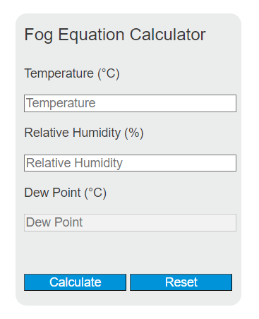
Calculate dew point, relative humidity, and fog risk from air temperature plus humidity or dew point in Celsius, Fahrenheit, or Kelvin.
Related Calculators
- Evaporative Cooling Calculator
- Lapse Rate Calculator
- Air Weight Calculator
- Initial Temperature Calculator
- All Physics Calculators
Fog Equation (Magnus-Tetens Approximation)
The dew point is calculated using the Magnus-Tetens approximation, the standard formula used in meteorology and aviation weather forecasting:
where:
- DP = dew point temperature (°C)
- α = (a · T / (b + T)) + ln(RH / 100)
- a = 17.27, b = 237.7°C (empirical constants calibrated for the liquid water phase, most accurate 0°C to 60°C)
- For ice surfaces below 0°C, use a = 21.87, b = 265.5°C for improved accuracy
- Formula error: less than 0.35°C across the -40°C to 50°C range; dew point errors typically under 0.1°C
Fog Formation Thresholds (T - DP Spread)
Fog risk is determined not by dew point alone, but by the spread between air temperature and dew point. These thresholds are used in aviation weather briefings and surface forecasting:
| T - DP Spread | Fog Risk | Typical Visibility |
|---|---|---|
| 0°C (0°F) | Fog or low cloud forming / present | Under 1/4 mile (dense fog advisory threshold) |
| 1°C (2°F) | Very high; likely at night with calm winds | 1/4 to 1 mile |
| 2°C (4°F) | High; monitor for overnight radiative cooling | 1 to 3 miles |
| 3-5°C (5-9°F) | Moderate; possible with additional cooling or moisture advection | 3+ miles typical |
| >5°C (>9°F) | Low risk under normal conditions | Good visibility |
Types of Fog
| Type | Formation Mechanism | Required Conditions |
|---|---|---|
| Radiation | Surface radiates heat overnight; overlying air cools to dew point | Clear skies, calm winds (under 5 knots), high RH |
| Advection | Warm moist air mass moves over a cooler surface | Wind required; common along coastlines and over cold ocean currents |
| Upslope | Moist air rises over terrain and cools adiabatically to dew point | Sustained onshore or upslope flow, moist air mass |
| Steam (Evaporation) | Cold air flows over warm water; evaporation saturates the cold surface layer | Air at least 10°C colder than the water surface |
| Frontal (Precipitation) | Rain falls into dry air below, evaporates, and raises dew point to air temperature | Warm front with precipitation descending into a dry layer |
What is Dew Point?
Dew point is the temperature to which air must cool at constant pressure and moisture content for condensation to begin. It is an absolute measure of atmospheric water vapor content: unlike relative humidity, dew point does not change when air temperature changes unless moisture is physically added to or removed from the air mass.
Practical dew point reference values: below 10°C (50°F) feels comfortable and dry; 15-20°C (59-68°F) is noticeably humid; above 21°C (70°F) is oppressive. For fog prediction, the critical value is not the absolute dew point but the gap between current air temperature and dew point. A spread of 2°C or less with light winds and clear skies almost always produces fog by sunrise.
Example Calculation
Scenario: Evening observation shows T = 15°C, RH = 80%. Will fog form overnight?
- Calculate α: (17.27 × 15) / (237.7 + 15) + ln(0.80) = 1.025 + (-0.223) = 0.802
- Calculate DP: (237.7 × 0.802) / (17.27 - 0.802) = 190.6 / 16.47 = 11.6°C
- T - DP spread = 15 - 11.6 = 3.4°C
- Interpretation: Moderate fog risk. If temperature drops 3-4°C overnight (typical nocturnal radiative cooling on clear calm nights), fog formation is likely by early morning.