Calculate the missing height, distance, or angle in degrees from any two values using right-triangle trigonometry and common length units.
- All Math and Numbers Calculators
- All Distance Calculators
- Angle of Elevation Calculator
- Angle of View Calculator
- Ladder Angle Calculator
Distance Angle Formulas
A right triangle formed by a height (opposite side), a horizontal distance (adjacent side), and an angle of elevation produces three core formulas. Which one you use depends on which variable is unknown.
Solving for horizontal distance:
D = H / tan(a)
Solving for height:
H = D x tan(a)
Solving for angle:
a = arctan(H / D)
Where D is the horizontal distance from the observer to the base of the object, H is the vertical height of the object (or the vertical difference between two points), and a is the angle of elevation measured from the horizontal.
The tangent function is the correct ratio here because D and H are the adjacent and opposite sides of a right triangle relative to the angle. Using sine or cosine instead would calculate the slant distance (the hypotenuse) rather than the true horizontal ground distance.
Distance Multiplier Table for Common Angles
The table below shows how far away an object is horizontally for every 1 unit of height at various angles. This is the value of 1/tan(a), sometimes called the cotangent. In practical terms, if a building is 50 ft tall and you measure a 30 degree angle of elevation, the horizontal distance is 50 x 1.732 = 86.6 ft.
| Angle (degrees) | Distance per Unit Height (1/tan) | tan(a) |
|---|---|---|
| 5 | 11.430 | 0.0875 |
| 10 | 5.671 | 0.1763 |
| 15 | 3.732 | 0.2679 |
| 20 | 2.747 | 0.3640 |
| 25 | 2.145 | 0.4663 |
| 30 | 1.732 | 0.5774 |
| 35 | 1.428 | 0.7002 |
| 40 | 1.192 | 0.8391 |
| 45 | 1.000 | 1.0000 |
| 50 | 0.839 | 1.1918 |
| 55 | 0.700 | 1.4281 |
| 60 | 0.577 | 1.7321 |
| 65 | 0.466 | 2.1445 |
| 70 | 0.364 | 2.7475 |
| 75 | 0.268 | 3.7321 |
| 80 | 0.176 | 5.6713 |
| 85 | 0.087 | 11.4301 |
Notice the symmetry: the distance multiplier at 5 degrees equals the tangent at 85 degrees. At 45 degrees, the distance equals the height exactly, making it a useful benchmark for quick mental estimates.
Angle of Elevation vs. Angle of Depression
The angle of elevation is the angle measured upward from a horizontal line to a line of sight aimed at an object above. The angle of depression is measured downward from the horizontal to a line of sight aimed below. Both use the same trigonometric relationships, and in a standard geometry setup the angle of elevation from point A equals the angle of depression from point B (because they form alternate interior angles with the horizontal).
This calculator works for both scenarios. When you are standing on flat ground looking up at a rooftop, you are working with an angle of elevation. When you are standing on a cliff looking down at a boat, you are working with an angle of depression. The math is identical: D = H / tan(a), where H is the vertical difference between you and the object, and a is the angle from horizontal.
Where Distance-Angle Calculations Are Used
Land surveying. Surveyors use theodolites and total stations to measure vertical and horizontal angles to reference points. From a known baseline distance, they calculate the positions and elevations of features across a site. The entire discipline of triangulation, used to map national boundaries and continental coastlines for centuries, rests on measuring angles between known points and computing distances from those angles.
Construction and building inspection. On a job site, workers calculate setback distances from building heights to confirm code compliance, verify that roof pitches match architectural drawings, and position cranes at safe operating radii. A crane operator who knows the boom angle and boom length uses these formulas to confirm the load radius before every lift.
Navigation. Celestial navigation has relied on angle-distance math for centuries. A sailor measures the altitude angle of a star above the horizon with a sextant, then uses trigonometric tables to determine distance from a known geographic reference point. GPS satellites use a related principle, calculating signal travel time (a proxy for distance) at known angles to triangulate a receiver's position.
Forestry. Foresters estimate tree heights with clinometers. They stand a known distance from the trunk, measure the angle to the treetop, and compute H = D x tan(a). Commercial timber volume estimates for entire forest plots rely on this sampling technique.
Smartphone apps. Augmented reality measurement apps on phones use the device's accelerometer to read the tilt angle and the user's entered or estimated eye height to calculate distance to objects. The underlying math is the same tangent ratio this calculator uses.
Effect of Small Angle Changes on Distance
The relationship between angle and distance is nonlinear, meaning a small change in angle does not always produce a proportional change in distance. At low angles this effect is dramatic. Changing the angle from 2 degrees to 3 degrees (a 1 degree shift) reduces the calculated horizontal distance by 33%. But changing from 44 degrees to 45 degrees only reduces distance by about 2.3%. The table below shows the horizontal distance for a fixed 100 ft height across a range of angles, illustrating this sensitivity.
| Angle (degrees) | Horizontal Distance (ft) for 100 ft Height |
|---|---|
| 1 | 5,729 |
| 2 | 2,864 |
| 5 | 1,143 |
| 10 | 567 |
| 15 | 373 |
| 20 | 275 |
| 30 | 173 |
| 45 | 100 |
| 60 | 58 |
| 75 | 27 |
| 80 | 18 |
| 85 | 9 |
| 89 | 2 |
This nonlinearity is why precision matters more at shallow angles. A 0.5 degree measurement error at 5 degrees produces roughly a 10% distance error, while the same 0.5 degree error at 60 degrees produces less than 2% distance error. Surveyors and engineers account for this by taking multiple readings and averaging results when working at low elevation angles.
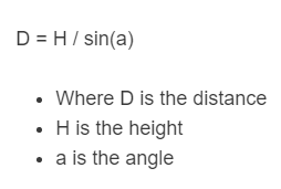
Horizontal Distance vs. Slant Distance
It is important to distinguish between horizontal distance and slant distance. Horizontal distance (D) is the ground-level measurement from the observer directly beneath the object. Slant distance (S) is the straight-line measurement from the observer to the object along the line of sight. The two are related by:
S = H / sin(a)
D = H / tan(a)
The slant distance is always longer than the horizontal distance unless the angle is exactly 90 degrees (directly overhead), at which point both equal the height. For practical purposes, at angles below about 10 degrees the two values are nearly identical (within 1.5%), so the distinction only becomes significant at steeper angles. At 45 degrees, the slant distance is about 41% longer than the horizontal distance. At 60 degrees, it is 15% longer. This calculator computes horizontal distance using tangent.
Measurement Tips for Accuracy
When measuring angles in the field, the biggest sources of error are instrument tilt, inconsistent eye height, and reading the angle scale incorrectly. For the best results: use a tripod or stable surface for the measuring device, measure the angle at least twice and average the readings, record your eye height and add it to the calculated object height (since you are measuring from your eye level, not ground level), and avoid measuring at very shallow angles (under 5 degrees) where small errors produce large distance errors as shown in the table above.
For distances over about 1 mile, Earth's curvature begins to affect results. At 1 mile the curvature drop is roughly 8 inches, and it increases with the square of the distance. Professional surveyors apply curvature and refraction corrections for long-range measurements, but for most practical applications under a few thousand feet, flat-Earth trigonometry is accurate enough.