Calculate environmental lapse rate from two temperatures and altitudes, or estimate temperature at a target altitude using a chosen lapse rate.
- All Physics Calculators
- Atmospheric Pressure Calculator
- Absolute Pressure Calculator
- Gas Density Calculator
- Air Density Calculator
- Barometric Formula Calculator
- Pressure Altitude Calculator
Lapse Rate Formula
The environmental lapse rate between two measurement levels is calculated as:
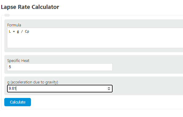
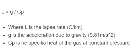
Where L is the environmental lapse rate (positive values indicate temperature decreasing with height), \(T_1\) and \(T_2\) are temperatures at levels 1 and 2, and \(Z_1\) and \(Z_2\) are the corresponding altitudes. Common units are °C/km or K/km. The dry adiabatic lapse rate has a separate derivation: \(\Gamma_d = g / c_p \approx 9.8\) °C/km, where g is gravitational acceleration (9.81 m/s²) and \(c_p\) is the specific heat of dry air at constant pressure (1005 J/(kg·K)).
Types of Lapse Rates
There are three principal lapse rates used in atmospheric science, each describing a different physical scenario.
Environmental Lapse Rate (ELR) is the actual, measured rate of temperature change in the atmosphere at a specific place and time. Meteorologists measure it using radiosondes (weather balloons carrying instrument packages). The ELR is highly variable because it depends on local radiation, convection, moisture, and surface conditions. The global tropospheric average is approximately 6.5 °C/km (3.56 °F per 1,000 ft), but observed values routinely range from negative rates (temperature inversions) to superadiabatic rates exceeding 10 °C/km near sun-heated desert surfaces.
Dry Adiabatic Lapse Rate (DALR) is the rate at which an unsaturated air parcel cools as it rises (or warms as it sinks), assuming no heat exchange with the environment. It is a thermodynamic constant: 9.8 °C/km (5.4 °F per 1,000 ft). This value comes directly from the first law of thermodynamics applied to a rising air parcel expanding against decreasing atmospheric pressure. The DALR does not depend on the actual temperature of the air, only on gravity and the heat capacity of dry air.
Moist (Saturated) Adiabatic Lapse Rate (MALR/SALR) applies to a saturated air parcel. As saturated air rises and cools, water vapor condenses and releases latent heat, partially offsetting the cooling. This makes the MALR always less than the DALR. Unlike the DALR, the MALR is not constant. It depends on temperature and pressure because warmer air holds more moisture, so more latent heat is released. Typical values range from about 3.6 °C/km in warm, humid lower-tropical air to roughly 9.2 °C/km in very cold, dry air near the tropopause where little moisture remains to condense. A commonly cited mid-latitude average is around 5 to 6 °C/km.
Atmospheric Stability and Lapse Rates
The relationship between the measured ELR and the adiabatic rates determines whether the atmosphere resists or promotes vertical air motion. This property, called atmospheric stability, is the foundation for forecasting convection, cloud development, and severe weather.
Absolutely Stable (ELR < MALR): When the environmental lapse rate is less than the moist adiabatic lapse rate, a displaced air parcel always cools faster than its surroundings, making it denser and forcing it back toward its original level. This suppresses vertical mixing and favors stratiform clouds, fog, and poor air quality under persistent inversions. Numerically, this typically means the ELR is below about 4 to 6 °C/km.
Conditionally Unstable (MALR < ELR < DALR): The most common state of the troposphere. An unsaturated parcel resists vertical displacement, but if forced upward long enough to reach saturation (the lifting condensation level), it begins cooling at the slower MALR and can become warmer than its surroundings. At that point the parcel accelerates upward on its own. This regime is responsible for cumulonimbus development and many thunderstorms, which occur only when a triggering mechanism (fronts, orographic lift, surface heating) forces air to its level of free convection.
Absolutely Unstable (ELR > DALR): When the environmental lapse rate exceeds 9.8 °C/km, even unsaturated air parcels become buoyant immediately upon displacement. This superadiabatic condition is most common in a thin layer just above sun-heated surfaces (typically the lowest 100 to 300 meters on hot days). It produces vigorous thermals, dust devils, and, if sustained through deeper layers, explosive thunderstorm development. Sustained superadiabatic lapse rates through the full troposphere are extremely rare and short-lived because convection quickly redistributes heat.
Temperature Inversions (Negative Lapse Rate): Temperature inversions occur when temperature increases with altitude. They represent extreme stability: vertical motion is almost completely suppressed. Common types include radiation inversions forming on clear nights as the surface cools rapidly, subsidence inversions caused by sinking air in high-pressure systems, and frontal inversions where warm air overrides cooler air. The persistent marine inversion layer off the California coast, typically located between 500 and 1,500 meters altitude, is one of the most well-studied examples. Inversions trap pollutants, moisture, and smoke near the surface and are directly linked to urban smog events.
ICAO Standard Atmosphere Temperature Profile
The International Civil Aviation Organization (ICAO) defines a standard atmosphere model used worldwide for aircraft altimeter calibration, engine performance tables, and engineering calculations. Its temperature profile through the lower atmosphere is defined by fixed lapse rates across distinct layers:
From sea level (0 km, 15 °C) to 11 km (the tropopause), the standard lapse rate is 6.5 °C/km, yielding a tropopause temperature of -56.5 °C. From 11 km to 20 km the temperature is held constant at -56.5 °C (isothermal layer in the lower stratosphere). From 20 km to 32 km the temperature increases at 1.0 °C/km, reaching -44.5 °C at 32 km due to ozone-layer UV absorption. From 32 km to 47 km the rate steepens to 2.8 °C/km, reaching -2.5 °C at the stratopause. These values assume a sea-level pressure of 1013.25 hPa, sea-level temperature of 15 °C (288.15 K), and sea-level density of 1.225 kg/m³. Real atmospheric conditions deviate from this model, but it provides the universal baseline for aviation and atmospheric engineering.
Lapse Rate by Atmospheric Layer
Troposphere (0 to ~11 km): Nearly all weather occurs here. The tropospheric lapse rate averages 6.5 °C/km globally but varies regionally and seasonally. Tropical tropospheric lapse rates are typically 6.0 to 6.5 °C/km because deep moist convection efficiently transports heat vertically. In polar regions, strong surface inversions in winter can push the lower-tropospheric lapse rate well below the global average. The troposphere’s lapse rate is fundamentally set by a balance between radiative cooling of the air (which, acting alone, would produce lapse rates around 10 to 15 °C/km) and convection, which activates whenever the lapse rate becomes too steep and redistributes heat upward.
Tropopause (~11 km at mid-latitudes): The tropopause is formally defined by the WMO as the lowest level above 500 hPa where the lapse rate drops below 2 °C/km and stays below that threshold for at least the next 2 km of altitude. Tropopause height varies from about 8 km at the poles to 16 to 18 km over the equator. It is not a fixed boundary but shifts with season, weather systems, and long-term climate change. Recent analyses of radiosonde and satellite data show the tropopause has risen by roughly 200 meters per decade over parts of Asia and the Middle East, consistent with tropospheric warming and stratospheric cooling.
Stratosphere (~11 to 50 km): Unlike the troposphere, the stratosphere is close to radiative equilibrium with minimal convection. Temperature increases with altitude through most of this layer because ozone absorbs solar ultraviolet radiation. This positive temperature gradient (negative lapse rate) creates extreme stability, effectively capping tropospheric weather systems. The stratopause near 50 km reaches approximately 0 °C before temperatures begin falling again in the mesosphere.
Real-World Applications
Aviation: Pilots use lapse rate data to predict temperature at cruising altitude, which directly affects air density, engine thrust, and lift. Aircraft performance charts are calibrated to the ICAO standard lapse rate of 6.5 °C/km. Deviations from the standard atmosphere require corrections to indicated altitude (pressure altitude vs. true altitude). On a day warmer than standard, the true altitude is higher than indicated, which matters for terrain clearance in mountainous regions. The density altitude concept, critical for takeoff performance calculations, is essentially a lapse-rate-derived metric.
Weather Forecasting: Forecasters analyze morning radiosonde data to assess the day’s convective potential by comparing the measured ELR to adiabatic rates. Key derived parameters include Convective Available Potential Energy (CAPE), Convective Inhibition (CIN), and the Lifted Index, all of which depend on lapse rate profiles. A steep ELR in the lower troposphere (approaching or exceeding the DALR) signals high thunderstorm risk, while a shallow ELR or inversion indicates suppressed convection and potential fog or stratus formation.
Mountain Meteorology and Foehn Winds: Lapse rates explain the dramatic temperature differences between windward and leeward sides of mountain ranges. Air forced up a mountain’s windward slope initially cools at the DALR (9.8 °C/km). If it reaches saturation, it continues rising while cooling at the slower MALR and losing moisture as precipitation. After crossing the summit, the now-drier air descends the leeward side, warming at the DALR. Because it lost moisture (and latent heat) on the way up but warms at the full dry rate on the way down, the leeward air arrives substantially warmer than at the same altitude on the windward side. This is the mechanism behind foehn winds (Chinooks in North America, foehn in the Alps, nor’westers in New Zealand), which can raise leeward temperatures by 10 to 20 °C within hours.
Air Quality and Pollution Dispersion: Temperature inversions, where the lapse rate turns negative, trap pollutants near the surface. The depth and strength of the inversion determine the mixing height, which is the maximum altitude to which ground-level emissions can rise and disperse. Air quality models use lapse rate profiles as a primary input. Cities in basins surrounded by mountains (Los Angeles, Mexico City, Santiago) are particularly susceptible to persistent inversions and poor air quality.
Lapse Rate Feedback in Climate Science
In climate science, the lapse rate feedback is one of the key mechanisms that modifies how Earth’s temperature responds to changes in greenhouse gas concentrations. As the planet warms, the tropospheric lapse rate changes, and the pattern of that change differs dramatically by latitude.
In the tropics, warming is amplified in the upper troposphere relative to the surface. Moist convection efficiently transports additional latent heat upward, so the upper troposphere warms faster than the surface, decreasing the lapse rate. A warmer upper troposphere radiates more heat to space, partially counteracting the original greenhouse forcing. This is a negative lapse rate feedback, meaning it dampens overall warming in the tropics.
At high latitudes, the opposite occurs. Surface-based warming is strongest, particularly in the Arctic where sea ice loss exposes darker ocean water. The upper troposphere warms less than the surface, increasing the lapse rate. This means the upper troposphere does not radiate proportionally more heat to space, so less of the warming is offset. This positive lapse rate feedback contributes roughly 15% of observed Arctic amplification and about 20% of Antarctic amplification according to climate model analyses. The net global lapse rate feedback is slightly negative (estimated at roughly -0.5 to -0.8 W/m² per °C of surface warming), but the strong regional asymmetry between tropics and poles is a major driver of polar amplification, one of the most robust features of observed and projected climate change.
FAQ
The ICAO standard atmosphere defines the tropospheric lapse rate as 6.5 °C/km (3.56 °F per 1,000 ft) from sea level to 11 km altitude. This is an idealized average. The actual environmental lapse rate at any given location and time may differ substantially.
The dry adiabatic lapse rate (9.8 °C/km) applies to unsaturated air and is constant. The moist adiabatic lapse rate (typically 3.6 to 9.2 °C/km) applies to saturated air and is variable because condensation releases latent heat, which slows the cooling. The warmer and more humid the air, the greater the difference between the two rates.
Yes. A negative lapse rate means temperature increases with altitude, a condition called a temperature inversion. Inversions are common near the surface on clear nights (radiation inversions) and in the stratosphere (where ozone absorbs UV radiation). They represent very stable atmospheric conditions that suppress vertical mixing.
The lapse rate determines atmospheric stability, which controls whether air parcels rise or sink. Steep lapse rates promote convection, cumulus cloud growth, and thunderstorms. Shallow lapse rates or inversions suppress vertical motion, favoring fog, stratus clouds, and trapped pollution. Forecasters compare the measured environmental lapse rate against adiabatic rates to assess convective potential each day.